Contact
Kevin Hefferan
(508) 830-5277
khefferan@maritime.edu
Acknowledgments
Dr Kevin Hefferan
MMA Marine Operations Department
Professor William Hubbard
Professor Joe Osborne
Amy Wright
Rachel Fleck
Past MSSEP Cadets
Capstone Project: Eelgrass Monitoring
Marine Science, Safety, and Environmental Protection
Environmental Monitoring is a senior capstone class for MSSEP students that provides an invaluable opportunity for hands-on fieldwork and research in various environmental projects. The range of activities, from fish tagging to bird sightings to microplastic counting on beaches, offers students a diverse and comprehensive understanding of environmental monitoring techniques. Students not only learn how to conduct research effectively but also develop essential skills in data collection, analysis, and interpretation. By actively participating in environmental monitoring projects, students contribute to the ongoing efforts in environmental conservation and management.
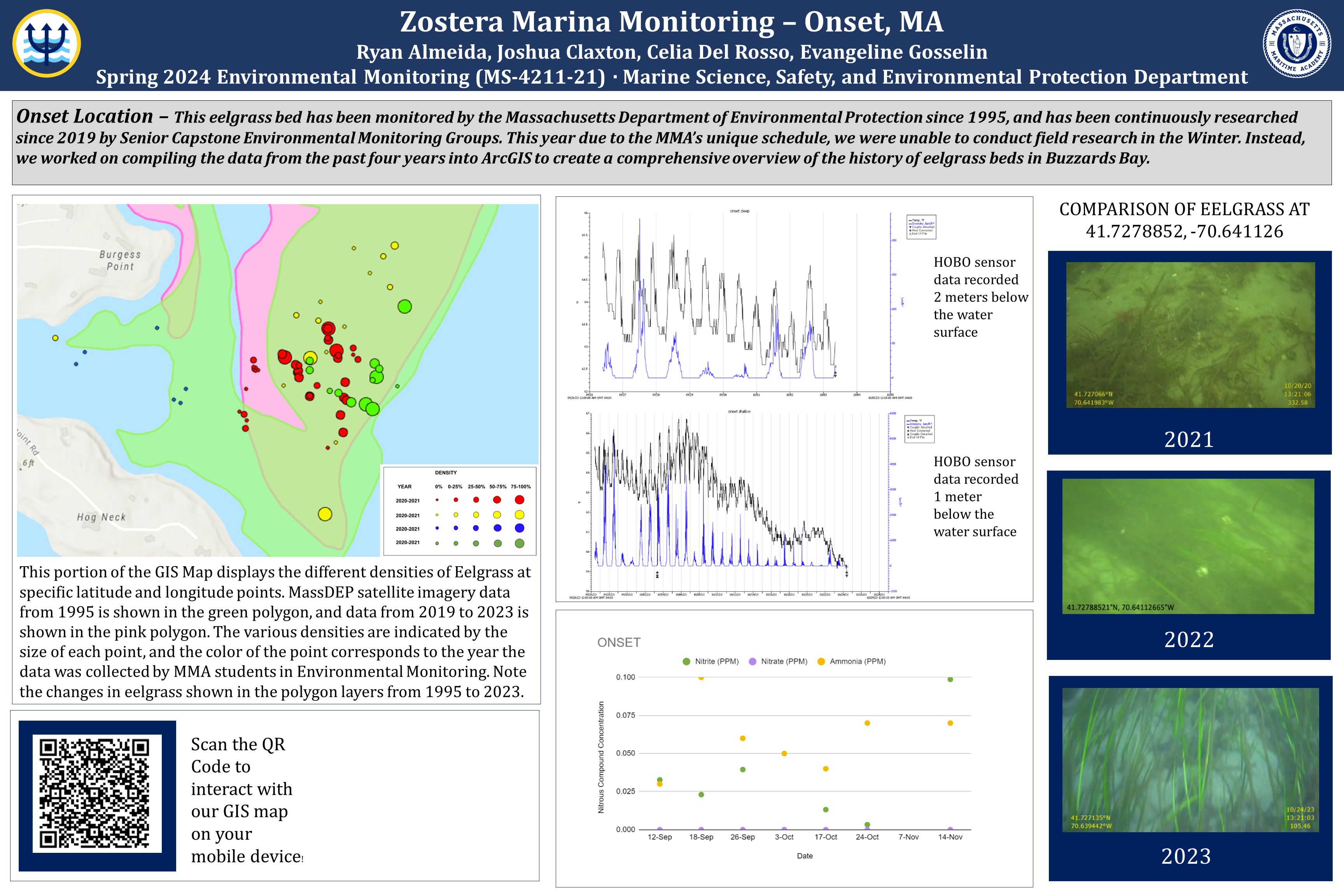
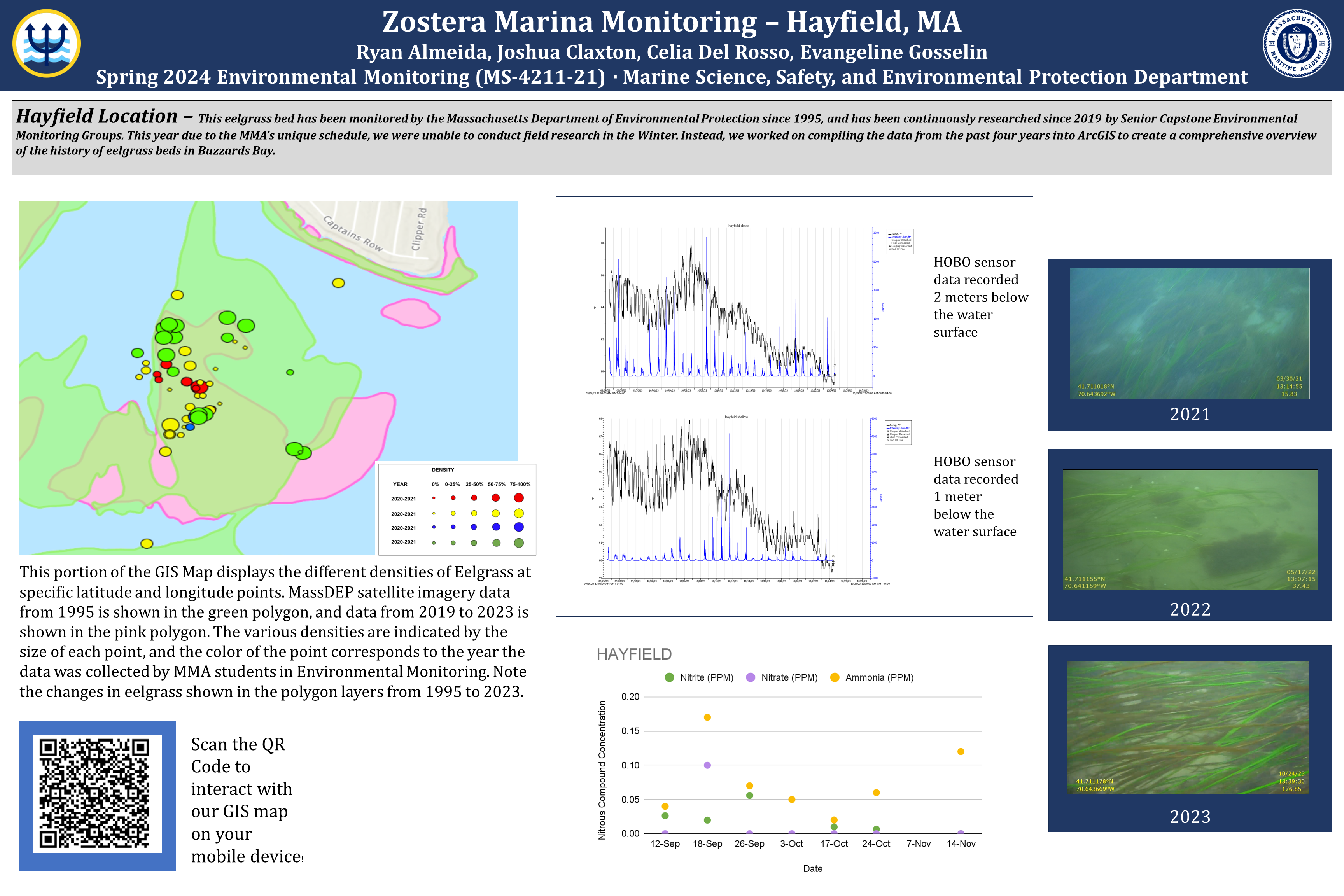
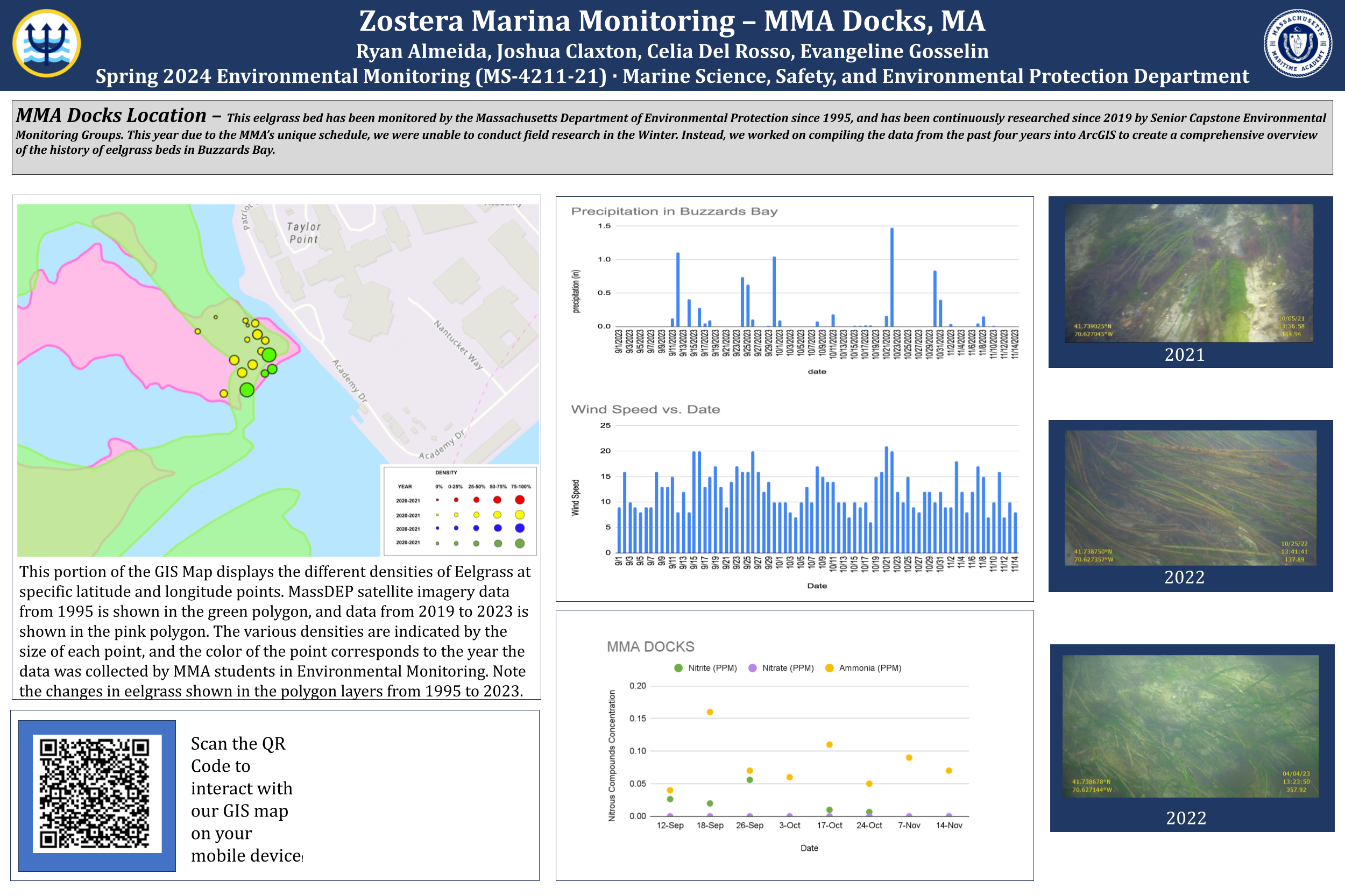
One exciting project focuses on monitoring Zostera marina, more commonly known as Eelgrass. Throughout the Fall semester, students embarked on weekly research trips on the Zostera center console vessel, deploying an underwater camera to track eelgrass density in Onset, Hayfield, and Bourne. Eelgrass serves as a reliable indicator of water quality, thriving in areas with sufficient light penetration and balanced nutrient levels. Using GIS software, the group documented latitude and longitude coordinates and analyzed nitrous compound concentrations in the water to assess the impact of eutrophication on this species.
During the winter months, the group was limited to indoors due to the harsh weather conditions on the water. They collated data collected by previous student groups over the past four years. This data was compiled into ArcGIS for comparison of eelgrass changes over time. Additionally, the Massachusetts Department of Environmental Protection satellite imagery of eelgrass beds from 1995 to 2023 was overlaid onto the map to provide a representation of visual changes in density over the years. This integration of data into GIS significantly enhances its accessibility and utility for the scientific community. The team's aspiration is for future groups to continue this study, adding their data to the ArcGIS map, thereby enriching the dataset over time and providing a more accurate depiction of eelgrass beds in Buzzards Bay.
interact with our ArcGIS Map and see the changes in Eelgrass over the years!