
Once again hello from the TS Kennedy! After a fun weekend docked in Barbados, we are back underway sailing. Getting to explore another country for the first time is an amazing experience that I’ve only had traveling on Sea Term.
This week, I am in the classrooms on the ship conducting my Deckie Training. Today, I worked on my Voyage Plan. The Voyage Plan is a project 3/C Deckies (Marine Transportation majors) work on throughout the entirety of Sea Term, to be turned in as a large part of our grade when we return home. A voyage plan is used on every ship undergoing any voyage. It is very important as it contains almost everything you need for a safe passage. I spent this morning selecting all of my charts I need for a theoretical voyage from Saint Thomas to Barbados. After selecting the charts, I charted way points and connected them with track lines. These are where I intended the ship to travel for the entire voyage. The most tedious part of planning, I will be working on in the coming weeks. I must put together a large report of information on both the ports in Saint Thomas and Barbados and everything in between. For the ports, this includes harbor pilot information and contacts, tug boat information, draft restrictions, depths of water, tides and currents at times of maneuvering, weather, legal restrictions, estimated times of arrival and departures, and much more. A voyage plan includes all the information you need whether a situation goes as planned or not. You must include a course of action for emergencies such as knowing where the nearest Coast Guard station is or having a backup port.
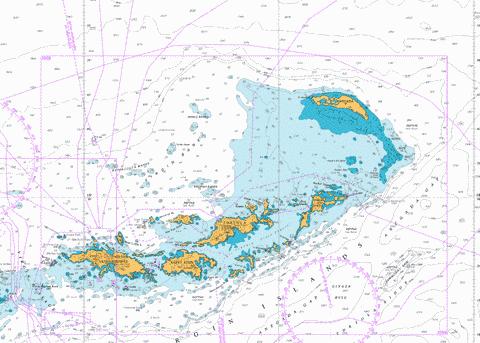
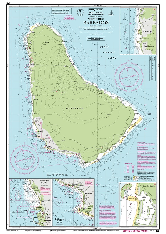
Along with these aspects, there comes plenty of mathematics with conducting the art of safe navigation. In order to find distances and/or courses, we use mathematics called “sailings”. There are different types of sailings we use for different scenarios. For distances under a couple hundred miles, trigonometry-based mathematics are used to determine course angle, distance traveled, and arrival or departure positions. For voyages over a couple hundred miles, we can’t use normal trigonometry to find the most efficient track line. Due to the curvature of the earth, a straight line from point A to point B isn’t actually the shortest distance. Thus we use “spherical trigonometry” to find what courses to travel and the distances it would be. Our mathematics does not stop at courses, distances, and positions though. In order to find the height of tides and direction/speeds of currents, we have to use tables and interpolation. Our tables have thousands of numbers for heights, directions, and speeds of tides and currents at hundreds of locations. Unfortunately for us, those numbers are never exactly the ones we need. To fix this, we have to interpolate using different methods to find the information needed. This comes into play for my voyage plan as I need to know the aspects of tides and currents at the exact time my voyage plan leaves Saint Thomas and arrives in Barbados.
I, along with my shipmates, have our work cut out for us to finish our Voyage Plans project. We practice now so when we become mates and eventually captains, our plans will always ensure success. Mathematics are very tedious as a Deckie, but good math is important to safe navigation. Thank you again for reading the blogs and as always, I’m happy to answer any questions.
Thank you for your informative blog, James. I hope that you will continue to update us on the progress of your Voyage Plan. It is great for our student followers to see that you are working on your project each day, and not procrastinating.
That is some serious mathematics that Marine Transportation majors use. You must have worked very hard in your elementary school, middle school, and high school mathematics classes.
We look forward to hearing from you again!